
Wondering where to take your kayak? Whether you are visiting the Holy City on vacation or you are looking for new locations to explore on the water, here is a list of 12 Charleston, SC kayak destinations.
Kayaking is a popular activity among Charleston residents and visitors alike. There are tons of places to go kayaking, and you can explore Charleston’s waterways for hours without a specific destination in mind. But, there are lots of incredible Charleston kayaking destinations as well, including destinations where you will feel like you are miles away from anyone else—because you are.
In this article, we’ve compiled a list of 12 of our favorite Charleston, SC kayak destinations. We’ve also included launching points for each destination, as well as some tips for planning your route. We also encourage you to read our article on kayaking in Charleston for some additional tips and considerations.
12 Incredible Charleston Kayaking Destinations
So, you want to go kayaking in (or near) the Holy City. Where should you go? Here are 12 incredible Charleston kayaking destinations:
1. Bird Key
Bird Key is located in the Stono Inlet, at the southern tip of Folly Island. It is a protected bird sanctuary, which means that access to this small sandy island is limited. As the South Carolina Department of Natural Resources (SCDNR) explains:
“Due to bird nesting activity, [Bird Key] is closed to public use from March 15 thru October 15. The area may be viewed from boats during these months and is accessible to the public below the high-water tidal line from October 16 thru March 14.”
The SCDNR’s website also indicates that Bird Key is closed to the public year-round from one hour after sunset to one hour before sunrise. So, if you head toward Bird Key for the perfect sunrise photo, just make sure you stay in your kayak until you are permitted to set foot on the island.
Getting to Bird Key By Kayak: There are two primary options for getting to this Charleston, SC kayak destination. You can either put your kayak in the water at the Folly River Boat Ramp (97 Center St, Folly Beach, SC 29439) or the Sol Legare Public Boat Landing on the Stono River. From the Folly River Boat Ramp, it is about 3.25 miles to Bird Key. From the Sol Legare Public Boat Landing, the distance to Bird Key is about 4.5 miles.
 2. Bull Island
Bull Island is located north of downtown Charleston, and it is a popular destination for nature tours. But, you can also visit Bull Island on your own by kayak. Bull Island has roughly seven miles of undisturbed beach, and it is also home to Boneyard Beach, which is a popular destination for photographers. While you may encounter a tour group depending on when you go, there is a good chance that you will have the entire island all to yourself.
Getting to Bull Island By Kayak: You can kayak to either the northern tip or the southern tip of Bull Island. The northern tip is closest to Boneyard Beach, and you’ll have incredible views of Bulls Bay on your route. You can get here from the Buck Hall Recreation Area Boat Landing (999 Buckhall Landing Rd, McClellanville, SC 29458), which is about 12 miles away via kayak. The southern tip of Bulls Bay is a great Charleston kayaking destination as well, and to get here you’ll need to plan for a roughly 18-mile roundtrip from the Isle of Palms Marina (50 41st Ave, Isle of Palms, SC 29451).
3. Capers Island
Capers Island is located just south of Bull Island. It is similar to Bull Island in that it is one of Charleston’s uninhabited sea islands that is rarely visited, except by the occasional kayaker, boater, or guided tour. Capers Island gets the most boat traffic on weekends during the summer months; so, if you want the island to yourself, plan to go during the week and/or during the off-season.
But, while Capers Island may be similar to Bull Island in some respects, both are well worth visiting as Charleston, SC kayak destinations. You can spend hours exploring each island—and you can even visit both on the same trip if you head toward Bull Island’s southern tip.
Getting to Capers Island By Kayak: Getting to the northern tip of Capers Island is the same as getting to the southern tip of Bull Island—they are just across the Price Inlet from one another. You can also visit the southern tip of Capers Island, which is a shorter trip (about six miles each way) from the Isle of Palms Marina.
4. Crab Bank
Crab Bank is located in the Charleston Harbor at the mouth of Shem Creek. Similar to Bird Key, Crab Bank is a bird sanctuary that is protected under South Carolina law. According to the SCDNR, the “hours of operation” for Crab Bank are the same as those for Bird Key. This means that while you can kayak around Crab Bank year-round, you can only set foot on the island below the high-water tidal line from October 16 through March 14, and only between one hour before sunrise and one hour after sunset.
Crab Bank is a sandbar that is completely submerged at high tide. So, if you’re planning to visit this Charleston, SC kayak destination, you’ll want to plan to go as close to low tide as possible.
Getting to Crab Bank By Kayak: While there are several options for kayaking to Crab Bank, most people leave from the Shem Creek Boat Landing (109 Simmons St, Mt Pleasant, SC 29464). From here, it’s only about a mile to Crab Bank. Keep in mind that Shem Creek can get very busy with boats, so you’ll most likely want to plan your kayaking trip to Crab Bank in the morning—and on a weekday if possible.
5. Drum Island
Drum Island is located in the Charleston Harbor below the Ravenel Bridge. For years, Drum Island was used as a deposit location for dredging material from the channel in the Charleston Harbor, and this caused significant damage to the island’s ecosystem. However, thanks to a restoration project started in 2023, the island is gradually being restored to its natural state.
Today, Drum Island is a Charleston, SC kayak destination that is well worth visiting. The island has narrow beaches along its shores, particularly on the western side. While you may encounter a few boaters on the beach, there is room to spread out, and there is a decent chance that you will have this island (and its unique view of the iconic Ravenel Bridge) all to yourself.
Getting to Drum Island By Kayak: The shortest route to Drum Island by kayak is from the Remleys Point Public Boat Landing (112 2nd St, Mt Pleasant, SC 29464) in Mount Pleasant. From here, you can kayak almost due west past the northern tip of the island, then work your way along the island’s west-facing coast until you find a spot where you want to get out. Just keep in mind that the wind and swell can make kayaking in the Charleston Harbor more challenging than kayaking in other locations, and you’ll need to keep an eye out for boats as well.
6. Morgan Island
Morgan Island is one of the most unique Charleston kayaking destinations you can possibly visit—and perhaps one of the most unique kayaking destinations in the entire United States. While you cannot set foot on Morgan Island, you can kayak around it—and the roughly 20-mile circumnavigation route is well worth the effort.
Why is Morgan Island so unique, and why can’t you get out of your kayak on the beach? Morgan Island is federally protected because it is home to a colony of approximately 4,000 rhesus monkeys. You can see the monkeys from the water (early morning is the best time to go—as long as you plan your route to take advantage of the tides), and if you go all the way around the island you will have views of the ACE Basin that few people ever see.
Getting to Morgan Island By Kayak: To get to this Charleston, SC kayak destination, you can either launch from the Eddings Point Landing (500 Eddings Point Rd, St Helena Island, SC 29920) or the Sams Point Boat Landing (1009 Sams Point Rd, Beaufort, SC 29907). From either launching point, it is about five or six miles to the beach on the island’s southwestern side where the monkeys live, and the circumnavigation route is roughly 20 miles as noted above.
7. Morris Island
Morris Island is located at the mouth of the Charleston Harbor, just inside the jetties. But, you don’t have to navigate the harbor to get to this Charleston kayaking destination. Kayaking from the Folly River Boat Ramp is a great option that allows you to wind your way through the marshes behind Folly Island before arriving at Morris Island.
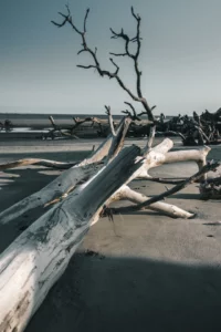
Morris Island is known for two things: the decommissioned Morris Island lighthouse and its abundance of shark teeth. Morris Island is widely considered to be one of the best places to hunt for shark teeth in Charleston. But, even if you’re not interested in combing the beach for fossils, the paddle to Morris Island is worth it for the views alone.
Getting to Morris Island By Kayak: You can kayak to Morris Island from the Folly River Boat Ramp. Once you launch your kayak, head north on the Folly River as it weaves its way toward Lighthouse Inlet. When you see the lighthouse, Morris Island will be on your left. On your right is the Lighthouse Inlet Heritage Preserve, which is also a great destination—though it is also accessible by foot on Folly Island.
8. Otter Islands
The Otter Islands are located in the ACE Basin, about 3.5 miles east from the easternmost point of Morgan Island. They are rarely visited—even more so than Bull Island and Capers Island. While you can plan a day kayaking trip to the Otter Islands, you can also camp here (with a permit) from November through March. You can request a permit by calling SCDNR’s McKenzie Field Station at (843) 844-8822.
Due to their location and limited accessibility, the Otter Islands are among the wilder Charleston, SC kayak destinations you can visit. You are almost certain to be here by yourself, though the SCDNR notes that the islands are home to “white-tailed deer, raccoons, bobcat, rattlesnake, and a variety of songbirds, waterfowl, wading birds and shorebirds.” While you are likely to find many would-be souvenirs on the beach, taking anything from the Otter Islands is prohibited.
Getting to Otter Islands By Kayak: You can either kayak to the Otter Islands from Eddings Point Boat Landing or Sams Point Boat Landing—instead of going around Morgan Island, keep going to the southern tip of the Otter Islands in the distance. This is a relatively long paddle with a 3.5-mile crossing, so it is important to make sure you are comfortable with the route and plan your trip carefully. You can also get to the Otter Islands from Edisto Island, either departing from The Marina at Edisto Beach (3702 Docksite Rd, Edisto Island, SC 29438) or the Live Oak Boat Landing (Oyster Row Ln, Edisto Island, SC 29438) on Big Bay Creek.
9. Rantowles Creek
 Rantowles Creek is a very different Charleston, SC kayak destination from the ones we’ve covered so far, but it is equally worth checking out for its own reasons. You won’t be getting out of your kayak, but you will be exploring miles of narrow creeks that meander through historic rice fields and untouched marshlands. There is a marked kayak trail that you can follow heading north from Bulow Landing, which will take you on an approximately four-mile loop route through the marsh. You will be following the obvious loop that is visible on the satellite view on Google Maps.
Getting to Rantowles Creek By Kayak: To get to Rantowles Creek, you will need to drive to Bulow Landing (Bulow Landing Rd, Ravenel, SC 29470). Bulow Landing is located on the creek; and, while you can paddle either direction, the loop route we just mentioned is north of the landing. Follow the widest waterways you can, and after roughly three-quarters of a mile of fairly straight paddling, you should see the first kayak trail marker (a silver circle with a green arrow) on your right.
10. Seabrook Island Beach and Deveaux Bank
Seabrook Island Beach and Deveaux Bank are located at the mouth of the North Edisto River. While Seabrook Island Beach is open to the public below the high-tide water line year-round, Deveaux Bank is another protected bird sanctuary. According to the SCDNR, the rules for visiting Deveaux Bank are as follows:
“Deveaux Bank Seabird Sanctuary is closed year-round above the high-water line with the exception of areas designated by signs for limited recreational use. Seasonal closure of the intertidal zone (beach) for nesting coastal birds is from March 15 through October 15. Closed areas will be demarcated by symbolic fencing. The beaches on the ends of the island, facing inland, will continue to be open year-round.”
Deveaux Bank is about half a mile from Seabrook Island Beach at its closest point—and the crossing is doable as long as you check the wind, swell, and tide before you go. You also have the option of paddling to the beach on the north end of Edisto Island, which is just inland from Deveaux Bank and directly across from Seabrook Island Beach.
Getting to Seabrook Island Beach and Deveaux Bank By Kayak: The closest put-in for visiting these Charleston, SC kayak destinations is Cherry Point Boat Landing (Boat Landing Alley, Wadmalaw Island, SC 29487). From here, it is just under three miles to the closest point on Seabrook Island Beach, and about four miles to Deveaux Bank.
11. Shem Creek
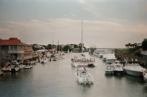 While Shem Creek serves as the access point for Crab Bank, it is also well worth paddling on its own. You’ll be paddling by shrimp boats and waterfront restaurants, and Shem Creek was used as one of the main filming locations for the Netflix show Outer Banks. It is not uncommon to see pods of dolphins in Shem Creek; and, in addition to paddling out into the Charleston Harbor, you can also paddle upstream to get away from the boats and crowds.
Getting to Shem Creek By Kayak: To kayak in Shem Creek, you’ll simply need to drive to the Shem Creek Boat Landing. If you are vacationing in Charleston, you can rent a kayak or take a guided kayak tour here as well.
12. Wolf Island
Wolf Island is an inshore uninhabited island with a small beach and a canopy of live oaks. Both are equally worth the trip. Since this is an inshore Charleston kayaking destination, it is easily accessible most days—though you should still check the forecast to make sure you are comfortable with the wind and swell. If you are kayaking here on the Rantowles Creek from Bulow Landing, you may want to plan your trip to ride the tide each way as well.
Getting to Wolf Island By Kayak: You can either kayak to Wolf Island from Bulow Landing (about 3.5 miles each way) or from the John P. Limehouse Landing (495 Main Rd, Johns Island, SC 29455) on Johns Island. From here, Wolf Island is only about a mile away—head west on the Stono River and you will see Wolf Island’s beach on your right just a few minutes after you pass under the bridge.
Our Map of Charleston, SC Kayak Destinations
Interested in visiting one (or all) of these Charleston, SC kayak destinations? If so, you can use this map to plan your trip:
As always, when kayaking on Charleston’s coastal waters, it is important to plan for the conditions and bring everything you need to stay safe on the water (including your SCDNR-mandated personal floatation device (PFD)). Stay comfortably within your abilities, and kayak with a partner or group whenever possible.
Did you enjoy this article? Join our mailing list to get notified of new articles via email.