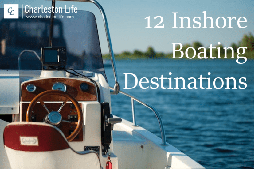
Many boaters in Charleston spend their days offshore. They’ll go out miles—if not dozens of miles—in search of amberjack, cobia, sailfish, mahi mahi, and other fish that live in Charleston’s offshore reefs and the Charleston Bump. But, what if you aren’t interested in offshore fishing? Or, what if you just want to spend a relaxing day on Charleston’s inshore waters?
In Charleston, there is no shortage of inshore boating destinations. This includes destinations on Charleston’s sea islands as well as destinations all along the area’s rivers and creeks. If you are looking for a place to go on your next outing, here are 12 inshore boating destinations to explore:
Choose a Destination for Your Next Inshore Boat Trip
1. Bird Key
Bird Key is located at the mouth of the Stono River, between the northern end of Kiawah Island and the southern end of Folly Beach. As a seabird sanctuary, it is managed by SCDNR and only accessible from October 16 through March 14—and only below the high water tidal line.
But, even if you don’t anchor and step onto the sand, Bird Key is still worth visiting as an inshore boating destination. The Atlantic Ocean sits just beyond; and, if you are a bird enthusiast, you can bring your binoculars or long lens (or both) and spend hours observing the island’s nesting birds from the water.
Getting to Bird Key: To get to Bird Key, take the Stono River toward the coast. If you are coming from Charleston, you will turn port side as soon as you pass through the Elliot Cut. If you are coming from points west, such as the John P. Limehouse Landing on Johns Island, you will turn starboard when you see the Elliot Cut ahead of you and the Stono Bridge on your right. From this point, it is roughly 13 miles to Bird Key.
2. Bull Island
Bull Island is located north of Charleston on the Intracoastal Waterway (ICW). It feels far away—because it is—and if you make it here, there is a good chance you will have the island and its 6.5 miles of undisturbed oceanfront beach to yourself.
While Bull Island has a dock, when boating here from downtown Charleston on the ICW, most people anchor at the island’s southern tip, across from Capers Island. Getting to the dock can be tricky (and isn’t necessary), as the water can get shallow quickly in Bulls Bay.
Getting to Bull Island: To get to Bull Island from the Charleston harbor, you will take the ICW about 15 miles from the Pitt Street Bridge—passing Sullivan’s Island, Isle of Palms, Dewees Island, and Capers Island along the way. Once you get past Capers Island, turn starboard, and you can anchor on the inshore side of the beach on Bull Island (on your left) well before reaching the ocean.
3. Capers Island
Capers Island is slightly closer than Bull Island, which makes it a slightly more popular inshore boating destination in Charleston. But, while you may be there with a dozen or so other boaters on a busy summer day, if you go early or in the offseason, you can expect to be there alone—if not with just one or two other intrepid souls.
Similar to Bull Island, most boaters visiting Capers Island from Charleston go to the island’s southern end. Also similar to Bull Island, there is an inshore beach on the tip of the island so boaters don’t have to worry about getting through the breakers to the ocean side. This beach connects to the island’s oceanfront, so boaters can anchor in calm water and explore Capers Island’s miles of oceanfront as well.
Getting to Capers Island: To get to Capers Island from Charleston, take the ICW past Sullivan’s Island, Isle of Palms, and Dewees Island. Once you are past Dewees Island, you will want to take the third inlet on your starboard side. If you take one of the first two, you risk hitting the bottom close to low tide. Anchor on the southern tip of the island across from Dewees Island.
4. Cat Island
Cat Island is a small inshore island on the Wando River. It is a popular inshore boating destination in Charleston not only for its relative remoteness, but also because it is a good place to find sharks’ teeth.
From the confluence of the Wando River and the Cooper River (near Drum Island and the Ravenel Bridge), Cat Island is approximately 13 miles away. From here, you will pass under the Wando River Bridge, the I-526 Bridge over the Wando, and the Clements Ferry Road Bridge that connects Daniel Island to Mount Pleasant.
Getting to Cat Island: Once you go under the Clements Ferry Road Bridge (just after passing Shipyard Park), you are just about two miles away. You will go around a bend to the left and a bend to the right, and then you will come to a point where the river splits (the waterway to the left is Guerin Creek). Cat Island is on the left bank of the Wando River just past this point. Look for the small beach surrounded by trees.
5. Cruising the ICW
You don’t have to have a specific end destination to have an enjoyable day on the water. Cruising the ICW is a great way to spend the day as well. The ICW runs along Charleston’s entire Atlantic coast, separating the mainland from the Holy City’s sea island.
The ICW has a channel designated by day markers. Unlike the navigation aids coming in from the Charleston harbor, on the ICW, the red day markers are always in the inland side, while the green day markers are always on the ocean side. You’ll know it’s an ICW day marker if it has a yellow triangle or square at the top. If you follow these, you can’t get lost; and, if you stay between them, you’ll always have plenty of water.
Getting to the ICW: You can get to the ICW from various marinas and public boat landings around Charleston. The ICW follows the Stono River from the North Edisto River through the Elliott Cut and Wappoo Creek, goes around the Battery in Charleston Harbor, and then continues behind Sullivan’s Island and Isle of Palms.
6. Historic Plantation District
Another inshore boating destination where you won’t get off of your boat (but will have plenty of classic Lowcountry views) is the historic plantation district on the Ashley River. Much of this area is idle speed only, so once you get here you will be going slowly and focusing on taking in your surroundings.
From the I-526 bridge over the Ashley River, the historic plantation district is only about four miles away. You will pass under a train bridge, which has a fairly low crossing height at high tide. If you need to have the train bridge opened, you can call 843-763-7563 (as of January 2023). You will know you are in the historic plantation district when you see Drayton Hall on your port side. From here, you can boat by Magnolia Plantation and Middleton Place.
Getting to the historic plantation district: To get to the historic plantation district from Charleston, take the Ashley River inland. Once you pass under the I-526 bridge, stay to the right near the docks, as the left side of the river can get shallow. Follow the river as it bends around to the left until you get to the idle speed zone.
7. Morris Island
While Morris Island sits at the opening of the Charleston harbor into the Atlantic Ocean, you can anchor just off of the north side of Morris Island without going offshore. Just be careful—there are areas here that can get shallow as well. Morris Island is popular among boaters for shelling and shark tooth hunting, in addition to its uncrowded beach and ocean views.
The Morris Island Lighthouse is located off of the southern tip of the island, away from where you will anchor; but, you can make the hike to see the lighthouse from up close if you choose. If you don’t want to walk that far, you can spend your time hunting for treasures, or simply relax on the sand.
Getting to Morris Island: To get to Morris Island, follow the navigation aids in the Charleston harbor past Fort Sumter. Watch your depth finder, and turn right when you start getting close to the beach. Anchor on the tip of the island or on its inland side on Schooner Creek.
8. Seabrook Island Beach
While Seabrook Island is a gated community, boaters can access Seabrook Island Beach from the water. Cherry Point Boat Landing is the closest public launching location, but boaters can get to the beach from the Wadmalaw River, North Edisto River, and Bohicket Creek as well.
For novice boaters, Seabrook Island has one of the easier beaches to visit. Anchoring on the inland side of the island is relatively easy, as you can mostly get out of the current, and the land drops off relatively quickly—making it less likely that you will get stranded if you aren’t watching your boat the whole time. But, since the beach is still a decent boat ride away from most of Charleston’s populated areas, at most you are only likely to encounter a handful of other boaters while you are there.
Getting to Seabrook Island Beach – To get to Seabrook Island Beach from points near Charleston, take the Wadmalaw River to the North Edisto River, then head toward the ocean. The tip of the island, where most people anchor, is about six miles away. As you approach the beach on your port side, go slow, decide where you want to disembark, then set your anchors and enjoy.
9. Shem Creek
Shem Creek is an inshore boating destination in Charleston where you can boat to lunch or dinner. Several restaurants on Shem Creek have boat docking for customers—and these are also some of the best and most-popular restaurants in the Charleston area.
Even if you don’t want to dock, a visit to Shem Creek is worth it just for the views. Several offshore shrimping and fishing vessels anchor here; and, once you get past the restaurants and commercial operations, Shem Creek feels surprisingly remote. Shem Creek is a popular destination for dolphins as well.
Getting to Shem Creek: To get to Shem Creek, head through the Charleston harbor toward Sullivan’s Island. As you get close to Sullivan’s Island, you will make close to a 180-degree turn to your port side to follow the navigation aids between Mount Pleasant and Crab Bank. While it might look like you could shorten your trip by going on the north side of Crab Bank, this is not recommended due to the water’s depth and potential underwater hazards.
10. Stono River Sandbar
The Stono River sandbar near the John F. Limehouse Memorial Bridge is also affectionately known as the “Redneck Riviera.” While it is only above the waterline for a couple of hours around low tide, it is a very popular destination among local boaters during the summer months.
The water surrounding the Stono River sandbar during low tide is only a few feet deep, so boaters often anchor a fair distance away from the sandbar when it gets crowded. But, during the offseason, you can bring a picnic and have this temporary island all to yourself.
Getting to the Stono River Sandbar: The Stono River sandbar is just a couple of minutes away from the John P. Limehouse Landing. If you are departing from here, go under the bridge and the sandbar will be on your right starting about an hour before low tide. Another option is to put in at Bulow Landing and follow Rantowles Creek to the Stono River, where you will see the sandbar on your left.
11. The Battery
The Battery at the tip of the Charleston peninsula is a popular destination and turnaround point for boaters starting their journeys on one of Charleston’s rivers. Here, you will have one of the most classic views of our picturesque city, with the historic homes south of Broad, Oyster Point, and the Ravenel Bridge all within view.
The Charleston harbor can get busy on good boating days, and the water in this area of the harbor can get choppy. So, you will definitely want to check the conditions before you go (which, of course, you should do no matter where you are headed on the water). But, on less-crowded days with calm conditions, getting here is no more challenging than getting anywhere else.
Getting to the Battery: To get to the Battery, take the Ashley River to the end of the Charleston peninsula, or follow the Cooper River under the Ravenel Bridge—staying between the navigation aids past Shutes Folly. As you turn toward the Battery, just keep an eye on the surface conditions, and make sure you don’t get too close where you can risk bottoming out at low tide.
12. Wolf Island
Wolf Island is located at the beginning of Rantowles Creek on the Stono River. This inshore island is also a popular weekend destination for local boaters; though, like most other inshore boating destinations in Charleston, Wolf Island is only ever at risk for getting slightly crowded on sunny weekend days.
Wolf Island has a beach that is a good place to look for sharks’ teeth, and beyond the beach is a sandy area with a canopy of live oaks. If you visit, be sure to pack out everything you pack in. Unfortunately, this is an area where trash sometimes gets left behind.
Getting to Wolf Island: To get to Wolf Island, follow the directions to the Stono River sandbar, above. If you are coming from the John P. Limehouse Landing, Wolf Island will be on your starboard side, on the left bank of Rantowles Creek. If you are coming from Rantowles Creek, stay to your right once you pass under the train bridge, and you will arrive at the beach just before entering the Stono River.
Did you like this article? Subscribe to get notified of new articles via email.