One of the great things about living in Charleston is that you can get outside just about any time of year—and many residents can walk, run, or bike in their own neighborhood. But, if you are getting tired of your normal route, if you want to branch out a bit, or if you are visiting Charleston on vacation, there are many other places you can walk, run, or bike in Charleston as well.
While we may not have many hills in the Lowcountry (and the closest mountain is about a three-hour drive away), there are still lots of interesting places to explore on foot or by bike in Charleston. Depending on what you want to see, you can pick a marsh trail or the sidewalk-lined streets on the peninsula (we’ll tell you which ones to choose), or you can head to the beach for a sunrise or sunset stroll.
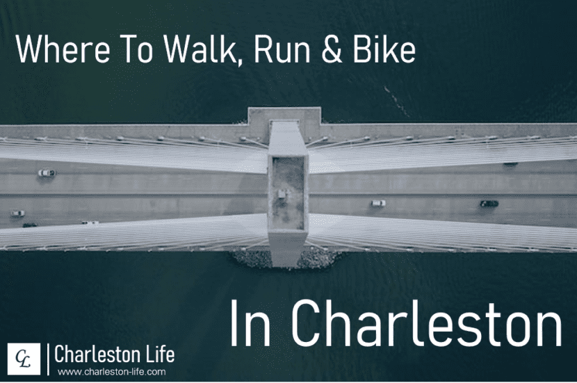
Looking for a New Place to Walk, Run, or Bike in Charleston? Here are 20 Free (or Low-Cost) Options
We fully realize that you can walk, run, or bike just about anywhere in Charleston, and we know that there are lots of public parks with walking and biking trails. But, many of these options are in private neighborhoods, or they have trails that are no more than a mile in length. For this list, we’ve come up with 20 places to walk, bike, or run in Charleston that (i) are free or cost no more than a few dollars to visit, and (ii) offer the ability to go several miles without going in circles (with just a couple of exceptions).
So, where can you walk, run, or bike in Charleston? Here are 20 recommendations:
1. Bear Island Wildlife Management Area
If you’ve never been to (or never even heard of) Bear Island Wildlife Management Area (WMA), you are not alone. This WMA is located south of town in the ACE Basin National Wildlife Refuge. In our experience, it rarely sees more than a handful of visitors a day, but there are several miles of grass trails that take you on a tour of the area and even go along the shore of the South Edisto River.
Bear Island WMA is also a popular hunting area, and it is closed to all users except hunters certain times of the year. You can visit the SCDNR’s website to see when you can go to walk, run, or bike. As of January 2023, the website states that Bear Island WMA is open for general public use “during daylight hours in designated areas from February 9 - October 31 (except during designated hunt periods).”
2. Biggin Creek Trail
Located north of downtown Charleston in Monks Corner, Biggin Creek Trail is something of a hidden gem. It is one of the few trails in the area where you can run hills (albeit small ones), and it is designed specifically for mountain biking. The trail is roughly a 4.5-mile loop. While it is generally well-marked with color-coded arrows to show in which direction you are traveling, there are a few tight turns where it can be tough to tell which way to go. So, downloading the map on AllTrails (or your other trail app of choice) is a good idea the first time you go.
3. Botany Bay
While Botany Bay is best known for its Driftwood Beach, it also has several miles of dirt roads that you can walk, run, or bike. The standard Botany Bay Tour Route is roughly 6.5 miles and consists of a loop with a roughly one-mile out-and-back. There are several points of interest along the route; and, if you are there during low tide, you can take the short trail to the beach to reward yourself for your efforts.
Similar to Bear Island WMA, Botany Bay is also closed for hunting during certain periods. You can visit the SCDNR’s website to view the hunting closure schedule.
4. Caw Caw Interpretive Center
Caw Caw Interpretive Center is a Charleston County Park that is free to visit with a Gold Pass, or $2 per person without one. While bikes are not allowed at Caw Caw, the park has several miles of smooth walkable and runnable trails that traverse woodlands, wetlands, and former rice fields. Caw Caw also has a long boardwalk through the marsh that is extremely fun to run (or walk). There are a lot of intersections and it is easy to get turned around, so it is a good idea to download the map or take a copy with you.
The longest trail at Caw Caw is the Habitat Loop, which is 3.6 miles and accessible via a short connector trail from the parking lot. But you can also connect several of the park’s trails for a longer route.
5. Charleston’s Beaches
Running at Charleston’s beaches is a treat whether you are a local or you are visiting on vacation. The streets at Edisto Beach, Folly Beach, Isle of Palms, and Sullivan’s Island are all pretty runnable (just take responsibility for your own safety, as always), and there are sidewalks and bike paths in many places. Some of the options for walking, running, or biking at Charleston’s beaches include:
- Edisto Beach – The main road into Edisto Beach has roughly three miles of bike lane on both sides. In the main beach area, there are sidewalks and bike lanes you can use to go all the way around the island. There are some great trails in Edisto Beach State Park as well.
- Folly Beach – At Folly Beach, it is generally safe to run on the roads, and the Save the Light Half Marathon and 5k takes place on Folly’s streets each February. If you head north on E. Ashley Avenue, you can go all the way to the Lighthouse Inlet Heritage Preserve. This is as close as you can get to the Morris Island Lighthouse without getting on a boat or kayak. Folly’s wide and flat beach is good for running, walking, and biking as well. Alternatively, you can head south toward Folly Beach County Park, which is free to enter when you’re on a bike or on foot.
- Isle of Palms – Isle of Palms is also a place where you can walk, run, or bike on the roads or on the sand (or both). The island is about six miles long from tip to tip, and you can go the entire length along the shore.
- Sullivan’s Island – The options for walking, running, or biking on Sullivan’s Island are also similar to those at Folly Beach. If you get a parking spot on Center Street, you can either head south toward Fort Moultrie for a view of the Ravenel Bridge and the Charleston peninsula, or head north and take the Palm Boulevard bridge to Isle of Palms.
6. Colonial Lake
Colonial Lake is located in downtown Charleston, in between Beaufain Street and Broad Street at Ashley Avenue. While the loop around Colonial Lake is only about half a mile, it’s a nice place to walk or run, and you won’t mind doing a handful of laps if you need to get your steps in or do some speed work.
7. Edisto Nature Trail
The Edisto Nature Trail is located on Savannah Highway south of town. The trailhead is on the right just after you cross over the Edisto River (before you get to the intersection with Route 64 that takes you to Walterboro). This is another shorter option—just about a mile and a half—but it is another one that you won’t mind doing a few times to make the drive worth the effort. The boardwalk through the forest is a highlight, as is the view of the Edisto River from the turnaround point on the short out-and-back spear.
8. Francis Marion National Forest
Francis Marion National Forest has dozens of miles of trails. There are several access points (the Buck Hall Recreation Area is a good one), and you can choose whether to run on singletrack through the woods, or stick close to the water for endless views. The trails here are easy to follow, so you can just pick a starting point and route, and then go as far as you want to go.
9. Laurel Hill County Park
Located in Mount Pleasant, Laurel Hill County Park is another Charleston County Park that is free to enter with a Gold Pass, or else $1 per person. If you run the entire trail system (which consists of four main loops), you will cover a total of approximately five miles.
10. Lockwood Drive and Murray Boulevard
If you are interested in running in downtown Charleston and don’t want to stick to Colonial Lake, another good option is to hit the sidewalks on Lockwood Drive and Murray Boulevard. These offer water views just about the whole way, and you will only encounter a handful of road crossings, most (if not all) of which have controlled pedestrian crossings. If you start from the large parking lot at Brittlebank Park (which does not have an admission fee), it’s about 2.5 miles to The Battery. This was at the start of the Charleston Marathon route (when there was still a Charleston Marathon), and it was definitely one of the highlights of the entire race.
11. James Island County Park
Located on Riverland Drive, James Island County Park has about 4.5 miles of paved and crushed gravel trails that are good for walking, running, and biking. They traverse the entire park, taking you through wooded areas and to the viewpoint at the fishing dock on the Stono River. Entry into James Island County Park is free with a Gold Pass, or $2 per person without one.
12. Johns Island County Park
Johns Island County Park is located a bit farther out, but it offers a roughly 6.5 mile trail system and far more seclusion than you’ll find at the much more popular James Island County Park. The trails here are a mix of wooded singletrack and grass horse trails. Admission is free with a Gold Pass or $2 per person without one.
13. Kiawah Island Parkway and Seabrook Island Road
For another road (or sidewalk) walking, running, or biking option, you can head past Johns Island County Park to Freshfields Village. If you park here, you can walk, run, or bike the sidewalks and bike lanes of Kiawah Island Parkway and Seabrook Island Road. From Freshfields Village to Kiawah Beachwalker Park and back is about five miles roundtrip (with some great views along the way), and the roundtrip to the gate at Seabrook adds about two more miles. On the way back, you can turn off to hit the boardwalk at Bohicket Marina.
14. Meggett County Park
Meggett County Park is a bit off the beaten path, but this means that it is another of the more-secluded options for walking, biking, or trail running in Charleston. Admission is free with a Gold Pass or $1 per person, and the red loop in the park is roughly 4.5 miles of singletrack. The trails at Meggett County Park can get muddy (and buggy) after it rains, so plan your visit accordingly.
15. Palmetto Islands County Park
Palmetto Islands County Park is Mount Pleasant’s answer to James Island County Park. It has about five miles of paved and well-manicured trails that are good for walking, running, or biking. Connect them all to visit the Nature Island Boardwalk, fishing dock, and observation tower in one push. This is another Charleston County Park, so admission is free for Gold Pass members and $2 for everyone else.
16. Patriots Point and Mount Pleasant Waterfront Park
Sidewalks connect Patriots Point and Mount Pleasant Waterfront Park, and it’s a little over a mile from the park’s parking lot (which is free) to the gate at Charleston Harbor Resort & Marina. Along the way, you’ll pass the U.S.S. Yorktown and Patriots Point Soccer Stadium, which is the home of the Charleston Battery. You can also connect this route with the next option on our list…
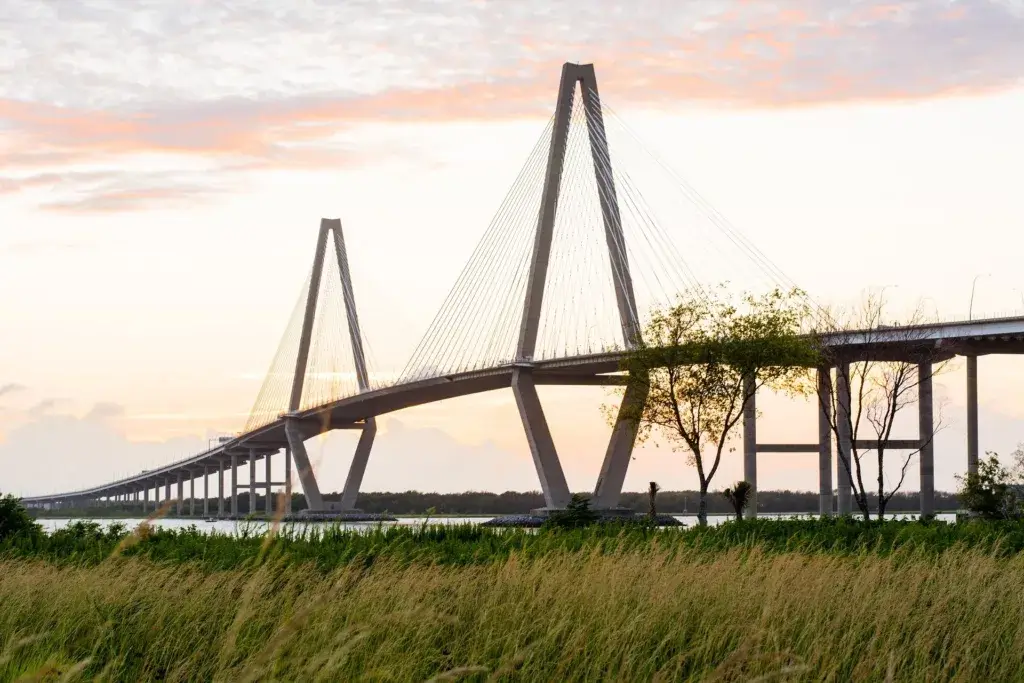
17. Ravenel Bridge
Walking, running, or biking the Ravenel Bridge is something you have to do at least once if you’re a local. While you can access the bridge from either side, it is easiest to park at Mount Pleasant Waterfront Memorial Park and follow the sidewalk that runs along the side of the bridge until you make a 180-degree turn and start your way up. From this side, it’s about 0.8 miles to the first set of benches; and, no matter which side you start from, the entire span is right around 2.5 miles. Along the way, you’ll officially climb (and descend) 187 feet in elevation.
18. Stono River County Park
Stono River County Park is a relatively new park located on Johns Island, just across the Limehouse Bridge from West Ashley. This small park consists primarily of a 1.5-mile trail that crosses a long boardwalk to two small islands with looped trails. You can run it twice to complete a 5k; or, if you are planning a long run or a long ride, you can connect the Stono River County Park trail to the West Ashley Greenway via McLeod Mill Road. Parking at Stono River County Park is free with a Gold Pass or $1 without one.
19. Wannamaker North Trail
As the Charleston County Parks and Recreation Commission (CCPRC) explains, “The Wannamaker North Trail runs within the north portion of Wannamaker County Park, but is only accessible from Goose Creek. The 13-mile trail is designed for and open to mountain bicyclists of all experience levels. The trail is also open to hikers, walkers, and runners, but pedestrians should know that the terrain contains tight curves and elevation changes.” The trailhead is located at 455 Westview Blvd. Goose Creek, SC 29445, and parking is free with a Gold Pass or $1 without one.
20. West Ashley Greenway
The final option on our list (based purely on alphabetical order) is the West Ashley Greenway. Roughly 7.5 miles in length, the West Ashley Greenway is flat, straight, and now mostly paved. It runs from Albemarle Road on the eastern end of West Ashley to McLeod Mill Road almost due west, and there are several access points with free parking along the entire route (including at both ends). While some sections of the greenway can get a bit boring, it’s a good place to go log some miles, and the marsh views on the western end of the trail are definitely worth the trip. As noted above, you can also connect the West Ashley Greenway to Stono River County Park.
Map of Places to Walk, Run, and Bike in Charleston
Here is a map with the parking lots and trailheads for each of the routes listed above. While some of these places to walk, bike, or run in Charleston have multiple access points, we’ve included just one (or, in some cases two) to keep things simple:
So, that’s a list (and a map) of 20 places to walk, bike, or run in Charleston. We hope you find this useful, and we encourage you to share it with anyone else who might find it useful as well.
Did you like this article? Subscribe to get notified of new articles via email.