
Wolf Island, an uninhabited gem in Charleston, SC, offers an exceptional escape accessible only by water. Tucked away at the confluence of Rantowles Creek and the Stono River, this island provides an unparalleled experience for kayakers and boaters seeking tranquility and natural beauty. In this comprehensive guide, we delve into everything you need to know about visiting Wolf Island, ensuring your trip is as rewarding and enjoyable as possible.
Discovering Wolf Island: An Untouched Sanctuary
The Allure of Seclusion
Wolf Island’s charm lies in its isolation. Despite being within sight of the bustling Main Road bridge, the island feels like a remote paradise. The gentle rustling of palmetto fronds and the soothing sounds of small waves create a serene atmosphere, perfect for those looking to escape the daily grind.
Scenic Kayaking Routes
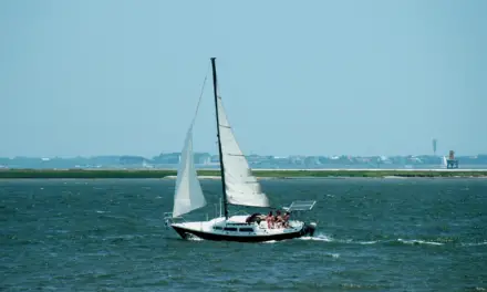
Starting Point: Bulow Landing Begin your adventure at Bulow Landing, a picturesque spot ideal for launching your kayak. The boat ramp at Bulow Landing is user-friendly, with ample space for maneuvering trailers. The initial stretch takes you through a narrow section of Rantowles Creek, flanked by two of Charleston’s most pristine waterfront neighborhoods: Bulow Plantation and The Preserve at Poplar Grove.
As you paddle through this stretch, the creek opens up, resembling a lake at high tide. Here, you can observe an array of wildlife, including egrets, herons, and gulls, making it a birdwatcher’s haven.
Navigating the Tides
Proper planning is crucial to avoid bottoming out your kayak or boat. We recommend leaving Bulow Landing about an hour and a half before low tide to ensure a smooth journey. Stay along the left side of the creek (heading southeast) to navigate the deepest sections and avoid getting stuck.
Key Landmarks and Scenic Spots
Savannah Highway Bridge Paddle under the Savannah Highway bridge and continue past a new development of multi-million-dollar homes. Soon, you’ll encounter a bend in the creek leading to a more secluded area, rich with marshland and wildlife. Dolphins, ibises, and even roseate spoonbills have been spotted along this route.
Railroad Bridge and Approaching Wolf Island As you approach the old railroad bridge, now devoid of its mechanical lift system, you’ll feel the creek rumble as trains pass overhead. Once past the bridge, Wolf Island comes into view, marking the final half-mile of your journey.
Wolf Island: A Natural Wonderland

Landing and Exploring
Upon arrival, you’ll land on a sandy beach before reaching the Stono River. If timed correctly, the tide should be nearly out, allowing you to explore the island without concern. Wolf Island boasts a canopy of majestic live oaks draped in Spanish moss, offering a spectacular setting for a picnic, photography, or a leisurely walk.
Activities on Wolf Island
- Beachcombing and Shark Teeth Hunting: The island’s beach is a treasure trove for those keen on finding shark teeth and other marine artifacts.
- Nature Walks: The live oak canopy provides a shaded, scenic area for walking and exploring the island’s natural beauty.
- Photography: Capture the stunning vistas of live oaks, marshlands, and expansive water views that Wolf Island offers.
Practical Information for Your Trip
Distance and Duration
- From Bulow Landing: Approximately seven miles round-trip, taking about three hours.
- From John P. Limehouse Landing: About two miles round-trip, with each leg of the journey taking 15 to 20 minutes depending on the tide.
Best Times to Visit
Wolf Island can be visited year-round, but for a more solitary experience, aim for weekday mornings or early weekend mornings when the tides are favorable.
Launching Points
- Bulow Landing: Located at the end of Bulow Landing Road, Ravenel, SC.
- John P. Limehouse Landing: Located at 495 Main Road, Johns Island, SC.
Safety and Tips
- Tide Awareness: Always check the tide schedule to avoid getting stuck. For kayakers, sticking to the main navigable areas can prevent bottoming out.
- Safety Gear: Ensure you have all necessary safety equipment, check the weather regularly, and dress appropriately for the water temperature.
- Navigation: Use a depth finder if you’re boating to monitor shallow spots and avoid grounding.
Conclusion
Wolf Island offers an extraordinary opportunity to immerse yourself in the natural beauty of Charleston’s waterways. Whether you’re paddling through the serene Rantowles Creek or exploring the island’s lush oak canopy, Wolf Island promises a memorable adventure. Plan your trip carefully, respect the natural environment, and enjoy the tranquility of this hidden gem.


