
Navigating the waters of Charleston can present a distinct adventure for those unfamiliar with coastal boating or kayaking. With its stunning scenery, including the iconic Ravenel Bridge and picturesque barrier islands, Charleston is a top destination for water enthusiasts. The area boasts several prime locations for both inshore activities and fishing, making it a truly appealing spot for all kinds of boating experiences.
Whether you choose to paddle through its winding rivers and creeks or embark on a kayaking excursion to remote islands, preparation is key. Understanding the tides and local conditions is essential for a safe and enjoyable outing. Careful planning will help you make the most of your day on the water, ensuring you are ready to adapt if the elements change.
3 Key Factors for Kayaking and Boating in Charleston: Tides, Swell, and Wind
1. Preparing for Tidal Changes
In Charleston, tides experience a significant shift, averaging around six feet every six hours. While this variation might not impact navigation in the main channels or Intracoastal Waterway, it can lead to grounding when exploring rivers or shallow areas. Many sandbars can emerge during low tide, and if you venture to the beach at that time, you risk being stranded until the tide rises again.
For kayakers, it’s crucial to pay attention to tidal times, particularly during spring tides when the low tide can drop even further than usual. Finding yourself without sufficient water can leave you stuck in mud with limited options for getting back into deeper water.
To effectively plan for tidal changes, consider these essential strategies:
- Establish Your Route – Develop a clear itinerary before setting off and share it with a trusted individual. Knowing your route allows you to review current tidal data, helping you adjust plans if necessary.
- Tide Assessment at Launch and Destination – Always check the tide levels at both your launch site and your destination. While high and low tides generally align, differences can occur based on your location within Charleston.
- Consult Depth Charts – Verify depth charts along your planned route, especially since Charleston is known for its numerous sandbars. Relying solely on your boat’s depth sounder can be misleading. Utilize marine navigation apps such as Seapilot for accurate depth information. This is particularly important around Capers Island or Morris Island, where underwater landscapes can shift dramatically.
- Know Your Vessel’s Draft – Understanding the draft of your kayak or boat is vital. If you’re renting a kayak or recently joined a boat club, ensure you’re aware of how much water is needed. While some flat-bottomed boats might operate on a foot of water, many motor boats require a minimum of three feet.
- Beach Visits During Rising Tide – If you’re heading to the beach, plan to arrive during a rising tide. This approach minimizes the chances of your boat being left high and dry. Avoid anchoring during low tide or immediate post slack tide to ensure enough water is available when it’s time to leave.
For kayakers, note that the current is strongest halfway between high and low tides, which can significantly affect your paddling effort. Strong winds have a compounding effect, making progress even more challenging. If you’re planning for an extended excursion, fuel consumption needs to be taken into account when managing the tidal journey.
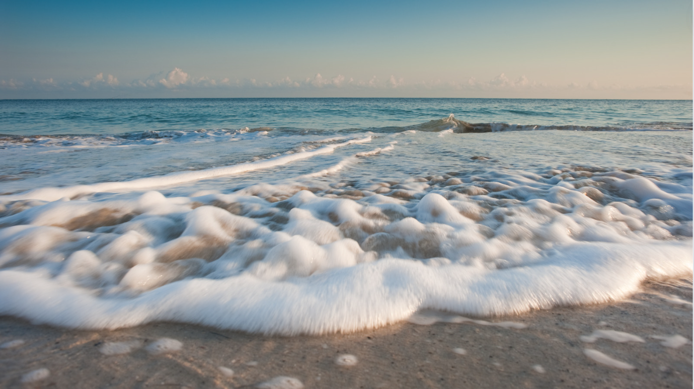
2. Assessing Swell Conditions
Swell conditions are another critical aspect of planning your kayaking or boating experience in Charleston. Swell refers to the surface waves that arise from wind, gravity, and storm systems, potentially originating from locations far away. Even on a favorable weather day, an unfavorable swell can create rough waters that could jeopardize both comfort and safety.
To gauge swell conditions, a variety of marine navigation apps can provide the necessary data. One popular choice is Windy, which, while free, offers valuable forecasts for wave conditions. When analyzing swell reports, two key components are significant:
- Swell Height – Measured from wave crest to trough, this indicator has a direct impact on your outing. For kayakers, swells above 1.5 feet may present discomfort. For boats over 20 feet, a swell height of two feet might be manageable, although swells reaching three feet could deter less experienced boaters.
- Swell Interval – The swell period measures the seconds between successive wave crests. Generally, for conditions to be deemed favorable, the swell period should at least double the swell height. Even with a safe swell period, swells exceeding three feet can result in rough experiences on the water.
On calm days in Charleston, expect swells under two feet with a swell period of ten seconds or longer. Such conditions represent the most optimal times for leisurely boating or kayaking. If you plan to paddle in sheltered areas, direct influence from swell conditions diminishes, allowing you to focus more on evaluating tides and wind.
To manage swell exposure effectively, your primary strategy should be to avoid unfavorable conditions whenever possible. Typically, swells decrease as you venture farther upstream. If conditions along the coast appear daunting, explore options on Charleston’s rivers, including the Wando, Cooper, and Ashley Rivers, or the more southern Stono, Wadmalaw, and Edisto Rivers.
3. Considering Wind in Your Navigation Strategy
Besides tides and swell, wind plays an essential role in determining the success of your kayaking or boating experience. An essential point to note is that wind speeds observed onshore can often underestimate the conditions faced on the water. To acquire accurate wind data, consult specialized weather tools or apps, such as Windy, or the marine forecasts provided by the National Weather Service.
Wind can impact your outing in several ways:
- Choppy Waters – Strong wind can lead to the development of wind waves that add to any existing swell, leading to rough and choppy conditions.
- Increased Resistance – Traveling against the wind requires greater effort and fuel. If you begin your outing with the wind at your back, be mindful of the return journey.
- Comfort Levels – High winds can lead to discomfort, turning an enjoyable trip into a less-than-pleasant experience. Strong winds not only lower temperatures but create situations where you and your passengers may find the spray intrusive. Coupled with adverse tidal and swell conditions, high winds are a good reason to reconsider your trip.
When planning for wind-related challenges, consider these additional tips:
- Wind Speed Assessment – Before heading out, check the wind speed and direction. Always be prepared for stronger winds on the water compared to land.
- Timing Your Trip – If windy conditions are anticipated, carefully plan your time on the water. Consider launching early when winds are typically calmer and returning before they pick up.
- Seeking Shelter – In strong winds, exploring sheltered waters can provide a more comfortable kayaking or boating experience. Narrower channels and inland rivers will often offer protection from harsh wind.
By considering these three fundamental factors—tides, swell, and wind—you can enhance your safety and enjoyment while kayaking or boating in Charleston’s diverse waterways.
Frequently Asked Questions
How Can You Determine the Direction of the Tide?
To identify the tide’s movement, you can observe the water’s edge for changes in its position. Watching for floating objects can also help; they will drift with the current. Additionally, using tide charts for Charleston can provide specific information on expected tide directions.
When is the Swell Too Large for Boating?
Swell conditions that exceed 3 to 4 feet can pose challenges for boating, especially for smaller vessels. It’s crucial to assess the conditions based on your boat’s size and your experience level. If you’re uncertain, it’s best to err on the side of caution and avoid heading out.
When is the Swell Too Large for Kayaking?
For kayaking, swells exceeding 2 feet may become difficult to navigate. Stronger swells can disrupt your balance and control. Always consider your skill level and the kayak’s design when assessing current conditions before launching.
What Wind Speed is Excessive for Kayaking?
Wind speeds above 15 knots can create challenging conditions for kayaking. You may encounter choppy water and reduced maneuverability. If winds reach 20 knots or more, it’s advisable to postpone your outing.
Is Swell Produced by Wind?
Yes, swells are primarily generated by wind over open water. The friction between wind and water surface creates waves that travel long distances. Factors such as wind speed and duration, as well as the distance over which it blows, influence swell size and power.
When Does Low Tide Occur in Charleston?
Low tide times in Charleston vary daily, typically occurring approximately six hours after high tide. Checking local tide tables will give you accurate low tide timings for any specific date.
What is the Size of Tides in Charleston?
Charleston experiences a tidal range of 4 to 7 feet, influenced by the Atlantic Ocean and local geography. This range allows for noticeable changes in water levels throughout the day.
What is the Tidal Range in Charleston, SC?
The tidal range in Charleston generally varies between 4 to 7 feet. This fluctuation is essential for planning activities such as boating, fishing, and kayaking, as it affects access to ramps and shorelines.
What Are Today’s High Tide and Low Tide Times in Charleston, SC?
To find specific high and low tide times for today, refer to online tide charts or local resources. These sources provide accurate, up-to-date information that is crucial for your planning.
How Do Tidal Changes Influence Boating in Charleston?
Tidal conditions significantly impact boating activities. The depth of water can change with the tides, affecting navigability in certain areas. It’s important to know tide timings to avoid grounding your vessel.
What Should Kayakers Consider Regarding Tides and Swells in Charleston?
Kayakers should monitor tidal changes and swell conditions before heading out. Understanding how tides affect water levels and currents is essential for safety. Always check forecasts to ensure you choose a suitable time for paddling.


